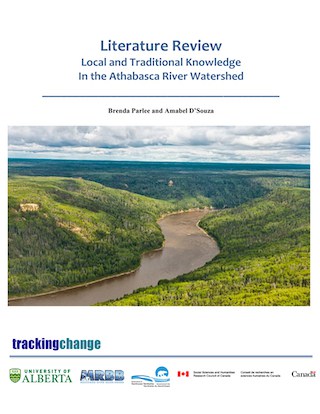
The Athabasca River
The Athabasca River originates in the Columbia icefields and ends in Lake Athabasca. The basin of the Athabasca River covers 138,412 square kilometers. Of this, 89% is in Alberta and 11% is in Saskatchewan. The system is comprised of 95 rivers and a minimum of 150 named creeks and lakes. It is joined by several large tributaries along its course including the McLeod, Pembina, Lesser Slave, and Clearwater rivers. The watershed is within both Treaty 8 and Treaty 6 territory, where each treaty notes the significant cultural value of the Athabasca River and watershed. For many indigenous peoples, “changes in the health and integrity of the Athabasca River consequently have a deeper set of political and cultural meanings”
The name of the Athabasca River is thought to have originated from the Woodland Cree word aeapaskāw meaning ‘where there are plants one after another.’ The watershed is home to at least nine Indigenous groups: the Dane-zaa, the Sekani, the Secwepmc (Shuswap), the Salish, the Ktunaxa, the Nadoka/Stoney, the Woodland Cree, the Chipewyan (Denesoline), and Metis. In 2001, the Athabasca river basin supported a population of 154,097 people … this includes all or parts of 22 rural or regional municipalities, one city, 12 towns, and 14 Indigenous settlements. The Watershed’s rich ecology also makes it home to a diverse population of terrestrial and aquatic wildlife. It is a source of life for “hundreds of fish, geese, ducks”, and more. Thus, the Athabasca Watershed is a historic waterway for Indigenous peoples.
A noted ecological stressor to the Athabasca Watershed is the W.A.C. Bennett Dam (in addition to the Peace River), which “irrevocably changed [the] patterns which fed the delta”. Additionally, the Athabasca Watershed is home to one of the largest, if not the largest, uranium reserves on the planet.
Quick Facts
- Drainage Area: 296,000 km2 (this came from the text currently on the Athabasca page – text above says 138,412 square kilometers – seems to be a discrepancy!).
- Human Population: Over 154,000Jurisdictions: Alberta, Saskatchewan, as well as Treaties 6, 8. Indigenous communities living along the Athabasca River include: Dane0zaa, Sekani, Ktunaxa, Secwepemc (Shuswap), Salish, Nakoda, Woodland Cree, Chipewyan, and Metis (and others).
- Ecology: Ecology of the Athabasca River is diverse: boreal forest, foothills, rocky mountains, small area of the Canadian shield, fish and other aquatic species, migratory birds, mammals, etc.
- Development: Hydroelectric development, agriculture, forestry, municipal/urban development, mining (uranium), oil and gas development (Fort McMurray).
- The Athabasca Basin is the world’s leading source of high-grade uranium and currently supplies about 20% of the world’s uranium. 10 of the 15 highest-grade uranium deposits in the world located within the basin.
- The W.A.C. Bennett Dam, constructed in 1967 has irrevocably changed the hydrologic patterns which feed the delta.
Community Research Projects
- Denesuline Perspectives from the Hatchet Lake First Nation sector gathering: Tracking Changes in Lakes and Rivers in the Athabasca Region – Price Albert Grand Council.
- Denesuline Elders and Youth Gatherings on the Health of the Aquatic Environment – Prince Albert Grand Council.
- Canoe Trip 2017 – Protecting our Environment for Future Generations – Exercising our Treaty Rights – Treaty 8 of Alberta.
- Placenames Mapping – Treaty 8 of Alberta.
- Ya Thi Nene Lands and Resources Youth Science/Culture Camp and Canoe Quest – Ya Thi Nene First Nation.
- Mikisew Cree First Nation Monitoring Program – Mikisew Cree First Nation.
- MCFN Tracking Change in the Peace Athabasca Delta through Community Based Monitoring – Mikisew Cree First Nation.
Learning From The Land
“This was our land. This was our livelihood, and they destroyed everything we had. They destroyed our water. They destroyed the air. They destroyed the bush. Like they cut all the trees down and chased all the animals away. You know?” (FMkFNIRC 2008: 32)
“When the oil sands plants opened it was good for jobs but it ruined our country. We won’t have fish or berries to eat. The animals will be unfit to eat and we won’t be able to drink the water. Our lifestyle will be different…” (Emma Faichney in FMkFN 1994: 81)
Related Publications
- Air Land and Water Planning - Mackenzie Athabasca
- Local and Traditional Knowledge in the Athabasca Watershed
- Uranium Exploration in the Athabasca Basin
- Facts About The Athabasca Basin
- About The Athabasca Basin
- Water Availability In The Athabasca River Basin
FMkFN—Fort McKay First Nation (1994) There is Still Survival out There: A Traditional Land use and Occupancy Study of the Fort Mckay First Nation. Calgary: Arctic Institute of North America
FMkFN-IRC – Fort McKay First Nation – Industry Relations Committee (2008a), Fort McKay First Nation. Traditional Knowledge Report. Parsons Lake Resources Park. Environmental Assessment Report. Calgary: FMA Heritage Resources Consultants Inc.
Quinn, F. (1991). As long as the rivers run: The impacts of corporate water development on Native communities in Canada. Canadian Journal of Native Studies
Co-Investigators
Brenda Parlee
Arn Keeling
Bruno Wichmann
Dave Natcher
Henry Huntington
Herman Michell
Jennifer Fresque-Baxter
Mark Nuttall
Shalene Jobin
Sonia Wesche
Trevor Lantz
Val Napoleon
Master Students
Laura Gaitan
M.A. Candidate, Geography

