The Amazon Basin
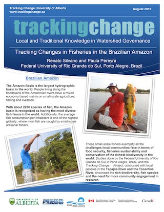
The Amazon Basin is the largest and more pristine watershed in Brazil with the highest freshwater fish diversity in the world and sustaining widespread small-scale fisheries. Although large tracts of the Amazon remain in good ecological condition, excessive fishing pressure had decreased the size and abundance of some large commercial fishes.
In the last decades, several locally based and bottom-up co-management systems emerged in the Brazilian Amazon, on which local communities manage fishing territories (usually floodplain lakes), by excluding outsiders that do not follow management rules, such as fishing restrictions or no-take areas. Co-management may improve fishing yields and increase fish abundance in the more productive white water floodplains.
Quick Facts:
- Area: 5.5 Million km2.
- Population: Estimated 30 million people, nine different political systems (see below). The Amazon basin is home to 350 ethnic groups, 60 of which remain almost completely isolated.
- Jurisdictions: Brazil (64%), Peru (10%), Colombia (6.2%), Bolivia (6.2%), Ecuador (1.5%), Venezuela (5.8%), Others – Guyana, Surinam, and French Guiana (5.9%)
- Ecology: The Amazon is typically warm all year round with temperatures from 22-43 degrees Celsius, there is also high humidity. Due to the size and variety of habitats, the Amazon basin is the most ecologically diverse place on Earth. The Amazon basin “houses at least 10% of the world’s known biodiversity, including endemic and endangered flora and fauna, and its river accounts for 15-16%of the world’s total river discharge into the oceans” (WWF, 2019). The Amazon River itself is over 6600 km long, has hundreds of tributaries and streams, and contains the most diverse and largest amount of freshwater fish species in the world (WWF, 2019).
- Average temperature of the Amazon is between 22-34 degrees C with high humidity.
- Most ecologically diverse place on Earth, housing at least 10% of the world’s known biodiversity, including endemic and endangered flor and fauna.
- Amazon river accounts for 15-16% of the world’s total discharge into the oceans.
- The Amazonian biome is two times the size of India.
- The Amazon river is over 6600 km long – contains most diverse/largest amount of freshwater species in the world.
- Development: Forestry and large-scale agricultural development. Currently, land clearing (through fire!) is significantly reducing forest canopy which may have an impact on the quality of water in Amazonian rivers. “The Amazon has lost at least 17% of its forest cover, its connectivity has been in has been increasingly disrupted, and numerous endemic species have been subjected to waves of resource exploitation” (WWF, 2019).
- 17% of the forest cover has been lost in the last 50 years.
- Currently, land conversion and deforestation in the Amazon releases up to 0.5 billion metric tons of carbon per year, not including emissions from forest fires.
- Most important international concern is deforestation.
Tracking Change In The Amazon
The Tracking Changes Project funded by SSHRC is working primarily with local peoples from the ribeirinhos or caboclos cultural groups. The project is looking at the use of natural resources and fishers in several Amazonian rivers including the Negro River, which has black water, the Toncantins River, which has clear water, and the Tapajos River. There is also some work being done in the white water Solimões and Lower Amazon rivers.
The work in the Amazon Basin is being primarily coordinated by Dr. Renato Silvano from the Universidade Federal do Rio Grande do Sul and Dr. Priscilla Lopes from the Universidade Federal do Rio Grande do Norte. A number of graduate students have supported the project.
Caboclos people are descendants of indigenous people and Portuguese colonizers, plus people of African descent, but more recently there has been immigration of people from Northeastern Brazil. They live along the floodplains of the large Amazonian rivers and have a mixed economy based mainly on small-scale agriculture (cassava, to produce flour), fisheries and cattle ranching. Such economic activities are closely dependent on the water cycle, marked by a low and high water season. Fisheries done by caboclos are usually artisanal. In some areas, the main fishing vessels are still paddled canoes, while in others low-power motorized canoes predominate. In general, fishing is done with multiple types of gear (handline, harpoons, and castnets), but the most widely used are gillnets. Fishers are usually low-income people with low political power, although some communities have organized themselves to get exclusive rights to certain fishing grounds through co-management systems, fishing accords, or extractive or sustainable reserves.
These riverine populations could be considered as being vulnerable, especially those from the Tapajos River, which has waters that are less productive and have lower fish biomass and lower availability of large-sized commercial fish. Furthermore, these people rely mostly on fish as a source of animal protein and are therefore more vulnerable to environmental or anthropogenic changes that could affect fish ecology and fish abundances, such as long and unusual periods of drought (climatic changes), dams, mining, and excessive fishing pressure.
The occurrence and efficacy of local co-management initiatives to promote biodiversity conservation or sustainable use of natural resources are largely unknown for most of the Brazilian Amazon, especially in the less productive black and clear water rivers. The Tracking Change research project is focused on this topic and is centered on the Tapajós River.
