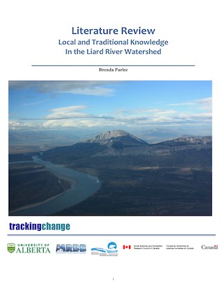
The Liard River
“The Liard River Basin is a complex multi-jurisdictional watershed. The Liard River begins its journey in the Pelly Mountains of southeastern Yukon, flows over 1,000 km southeast through northeastern British Columbia, and then crosses into the Northwest Territories, where it drains into the Mackenzie River” (Parlee, 2019: 2). Tributaries include the Dease, Hyland, Kechika, Coal, Trout, and Toad rivers. The 30 km long Grand Canyon of the Liard, with rapids called Hell’s Gate and Rapids of the Drowned, is located between the confluence of the Trout and Scatter rivers (Parlee, 2019:2). “There are roughly 9,000 people living in the Liard sub-basin. Most of the population is centered in Fort Nelson, BC, and Watson Lake, Yukon. Fort Simpson, which lies at the confluence of the Liard and Mackenzie rivers is considered in the Mackenzie-Great Bear Basin. First Nations people make up approximately 27% of the population. There are at least nine Aboriginal groups with historic or contemporary connections to the Liard River Watershed. Many of these groups relocated into British Columbia with the settlement of Alberta in the 19th century. Archival data suggests an important historic and contemporary value of fish species in the Liard River system. Twelve species of fish have been identified as important to local subsistence, including chum salmon. Sportfish species include Arctic grayling, chum salmon, bull trout, inconnu, lake whitefish, mountain whitefish, northern pike and burbot” (Parlee 2019: 2).
There are more than four main Indigenous groups with the historic use of the Liard Basin including the Kaska, the Sekani, the South Slavey, the Dogrib, the Beaver, the Hare, the Tahl-tan, and the Sauteaux (Parlee, 2019:7). Historically, the Kaska and Beaver Dena led nomadic lifestyles—hunting, trapping, fishing and traveled together in small family groups throughout the region and neighboring river basins. Settlement patterns change with exploration and trade (Gimbarzevsky et al., 1979).
There are limited sources of documented traditional knowledge about the Liard River Basin. Due to this, the need for more research involving indigenous peoples is high and relevant to the governance of the basin. However, it seems as though forestry has had the most significant impact on the Liard basin to date (Parlee, 2019: 2). Additionally, fish health is a major concern for communities of the Liard Basin due to the “significance of the fish to the diet, economy, and culture” (Parlee, 2019: 12).
The name “Liard” is derived from the French word for “Eastern Cottonwood” or Poplar, which grows along the river.
Quick Facts
- Drainage Area: River drains approximately 277,100 km2.
- Human Population: ~ 2741 people among the communities of Fort Simpson, Fort Liard, Lower Post (BC), Watson Lake, and Upper Liard – some other small communities along the river.
- Jurisdictions: Yukon, British Columbia, and Northwest Territories. There are more than four main Indigenous groups including the Kaska, Sekani, South Slavey, Dogrib, Beaver, Haire, Tahl-tan, and Sauteaux. Currently, five bands that comprise the Kaska Dena Nation are the Dease River First Nation, Daylu Dena, Kwadacha First Nation, Liard First Nation, and the Ross River Dena Council.
- Ecology: Boreal Forest, Muskeg, Arctic fish species and other aquatic species, mammals, Caribou, Moose, river banks.
- Development:
- Mining.
- Recreational Use.
- Conventional and Unconventional Petroleum Development.
- Oil and Gas Developments.
- Logging.
- Potential sites for hydroelectric development.
The Liard River was used as a route to the Yukon interior during the Klondike Gold Rish from 1897-99. Download
Alexander Mackenzie journeyed to the confluence of the Mackenzie and Liard rivers in 1789. Download
The Liard basin is home to wolverines, mountain goats, bison, Stone’s sheep, Dall’s sheep, red fox, beaver, muskrat, grouse, ptarmigan, and snowy owl. Additionally, moose, black bear, grizzly bear, snowshoe hare, and waterfowl. Download
Vegetation in the Lower Liard includes quaking aspen, white and black spruce, balsam fir, balsam poplar, and areas of wetlands including bogs and fens. Download
Community Research Projects
- Dr. Brenda Parlee “Local and Traditional Knowledge in the Liard River Watershed.”
- Deh Cho K’ehodi Youth River Trip – Fort Simpson to Willow Lake River.
- Baseline Water Monitoring in the Liard Watershed – Corrine Porter.
- Tracking Change on the Liard River – Corrine Porter.
Learning From The Land
“This was our land. This was our livelihood, and they destroyed everything we had. They destroyed our water. They destroyed the air. They destroyed the bush. Like they cut all the trees down and chased all the animals away. You know?” (FMkFNIRC 2008: 32)
“When the oil sands plants opened it was good for jobs but it ruined our country. We won’t have fish or berries to eat. The animals will be unfit to eat and we won’t be able to drink the water. Our lifestyle will be different…” (Emma Faichney in FMkFN 1994: 81)
Related Publications
- Air Land and Water Planning - Mackenzie Athabasca
- Local and Traditional Knowledge in the Liard Watershed
- Uranium Exploration in the Athabasca Basin
- Facts About The Athabasca Basin
- About The Athabasca Basin
- Water Availability In The Athabasca River Basin
FMkFN—Fort McKay First Nation (1994) There is Still Survival out There: A Traditional Land use and Occupancy Study of the Fort Mckay First Nation. Calgary: Arctic Institute of North America
FMkFN-IRC – Fort McKay First Nation – Industry Relations Committee (2008a), Fort McKay First Nation. Traditional Knowledge Report. Parsons Lake Resources Park. Environmental Assessment Report. Calgary: FMA Heritage Resources Consultants Inc.
Quinn, F. (1991). As long as the rivers run: The impacts of corporate water development on Native communities in Canada. Canadian Journal of Native Studies
Co-Investigators
Brenda Parlee
Arn Keeling
Bruno Wichmann
Dave Natcher
Henry Huntington
Herman Michell
Jennifer Fresque-Baxter
Mark Nuttall
Shalene Jobin
Sonia Wesche
Trevor Lantz
Val Napoleon
Master Students
Laura Gaitan
M.A. Candidate, Geography
